TUUL RIVER BASIN AUTHORITY: The Basin Authority is a state administrative organization responsible for protecting water resources within the basin from scarcity and pollution, ensuring the rational use and restoration of available resources, coordinating local and inter-sectoral water management, and implementing an integrated water resources management plan.
TUUL RIVER
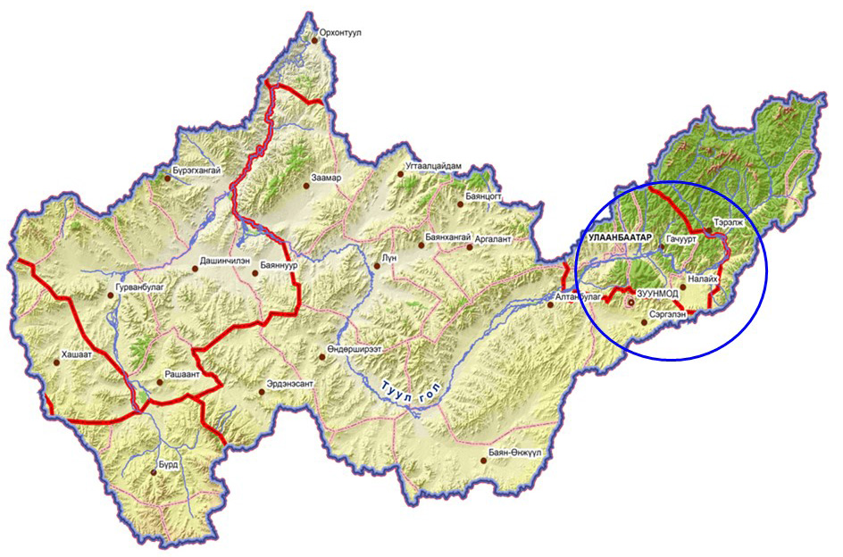
The Tuul River originates from the branches of the Khan Khentii Mountains in the Mungunmorit soum of Töv Province, specifically from the unnamed stream and the Nomyn River valley branching from the Baga Khentii Mountains. Its source point is located in Erdene soum, Töv Province at coordinates 48°30'58.9" N, 108°14'08.3" E, from where it flows under the name “Tuul” and eventually joins the Orkhon River in Orkhontuul soum, Selenge Province at coordinates 48°56'55.1" N, 104°47'53.2" E.
The total length of the Tuul River is 882.8 km, of which 119.8 km flow upstream of Ulaanbaatar (in Erdene soum, Töv Province), approximately 114.8 km pass through Ulaanbaatar city, and 648.2 km flow downstream. The river’s width ranges from 35 to 75 meters, with a depth of 0.8 to 3.5 meters.
In terms of natural zones and belts, the river initially passes through mountain taiga and forest-steppe zones, and flows through steppe zones downstream of Ulaanbaatar city. Most tributaries of the Tuul River originate from the branches of the Khan Khentii Mountains. In total, there are approximately 360 rivers and streams in the Tuul River basin, of which 50 rivers and 33 streams flow directly into the Tuul River.
TUUL RIVER BASIN
The Tuul River Basin covers the territories of 37 soums in 5 provinces and 144 khoroos in 7 districts of Ulaanbaatar city, with a total area of 49,774.3 km². The basin includes Ulaanbaatar city, Zuunmod city in Töv Province, 1 soum center in Arkhangai Province, 5 soum centers in Bulgan Province, 1 soum center in Övörkhangai Province, 1 soum center in Selenge Province, and 11 soum centers in Töv Province, totaling 18 soum centers.
Within the Tuul River Basin, special protected areas cover 5,847.75 km², which accounts for 11.7% of the total basin area.
Area of Specially Protected Territory
|
No |
Title |
Categories of Specially Protected Areas |
Area Covered by the Basin, km² |
|
1 |
Bogd Khan Mountain |
Strictly Protected Area
|
421.92 |
|
2 |
Khan Khentii |
986.68 |
|
|
3 |
Högne Tarna |
Nature Complex
|
841.43 |
|
4 |
Moltsog Els |
4.88 |
|
|
5 |
Khustai Range |
484.01 |
|
|
6 |
Gorkhi-Terelj |
2,901.01 |
|
|
7 |
Orkhon Valley |
16.57 |
|
|
8 |
Batkhaan Mountain |
Natural Resource Area
|
191.05 |
|
9 |
Chingeltei Khaikhan Mountain |
0.20 |
Role and Significance of the Tuul River Basin in Mongolia’s Socioeconomic Development:
Although the Tuul River Basin covers only about 3.2% of Mongolia’s territory, it is home to nearly 50% of the total population and produces approximately 70% of the country’s GDP, making it a region of critical importance for Mongolia’s social and economic development.
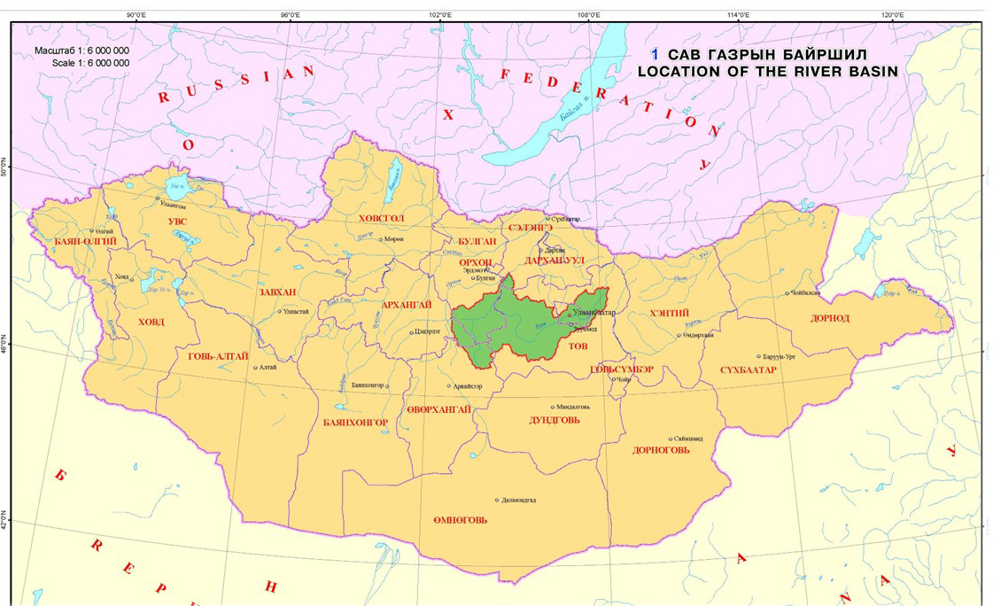
| Area | Population | Number of Livestock |
| Tuul River Basin: 49.8 thousand km² | Mongolia: 3.4 million km² | Mongolia: 64,681.8 thousand heads of livestock |
| Ulaanbaatar City: 3.1 thousand km² | Tuul River Basin: 1.5 million | Tuul River Basin: 4,165.2 thousand heads of livestock |